
Westshore Terminals

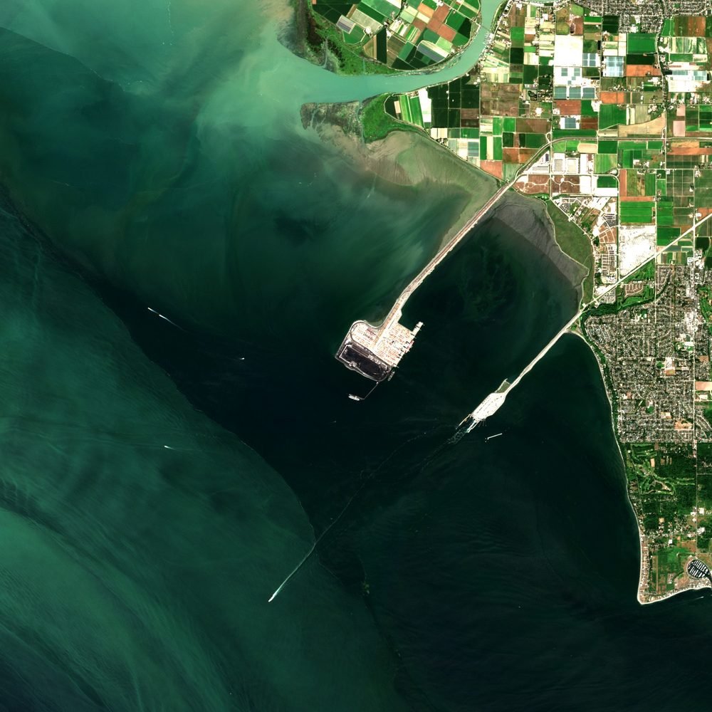
Sentinel-2, 7 August 2026. Imagery: Roger Wilco Imagery. Contains modified Copernicus Sentinel data 2026, processed by Roger Wilco Imagery. From the Canada Potash Sites baseline, under the Canada Potash Sites licence: free to use with credit for non-commercial purposes, and not for government use.
What it is
| Operator | Westshore Terminals |
| Owner | Westshore Terminals |
| Province or state | British Columbia |
| Where | Delta, British Columbia |
| Location | 49.02° N, 123.17° W, to about a kilometre. How it was placed: found and identified on satellite imagery (grade B) |
| Status | Being readied for Jansen |
| Also known as | Roberts Bank |
Numbers
What is where
| What | Position | Source |
|---|---|---|
| Terminal at Roberts Bank, as mapped in OpenStreetMap | 49.0184° N, 123.166° W | Roger Wilco Imagery, Canada potash baseline, 19 November 2026 |
Published positions, given as their source gives them. The game does not use them: it works on district totals.
Notes
- Contracted to handle Jansen Stage 1 potash to 2051. A further expansion has been deferred.
In the game
Not counted as production. It is recorded because the potash module assumes how much US-bound potash could be sold offshore instead, and that depends on what the terminals can handle.
This page describes the place. It holds nothing about the inside of the site and no assessment of how it could be damaged. Why.
Sources
- BHP Form 20-F for FY26, 6-K filings and the S-K 1300 Jansen technical report summary (SEC EDGAR), as cited in the inventory
- Roger Wilco Imagery, Canada potash baseline, 19 November 2026 (https://github.com/Prime-Rogue-Inc-Corporate/Canada-Potash-Sites): site positions with a confidence grade, and Sentinel-2 imagery
Transcribed from Prime Rogue Inc., Canadian Potash Sites Inventory, November 2026 (Kevin Duska), and not re-checked against the filings for this page. Units: million tonnes of finished KCl product a year, unless a line says otherwise.
Record in data/sites/potash.yaml, added in 0.1.3.9.